French Foreign Legion Indochina War 1954-55 Map 'Chantaburi'
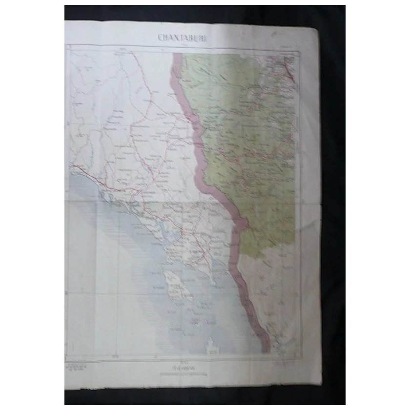
This Map was prepared in 1944 and published/printed 1954 - 1955. A rare map of CHANTABURI - Thailand - Cambodia Border. On the reverse there is a MAP GRID LOCATOR covering entire - French Indochine - Indochina - LAOS, CAMBODIA, VIETNAM ( N and S ), - this is same grid locator as used by Viet Minh - Viet Cong. The map measures - 24 x 18 inches (60 x 45 cm's). In very good condition for age...some staining and one tear approx 2" long on border bottom right just below fold.
Note: Checkout will occur on the merchants website, and will open in a new browser tab.
Molloy's MEGA Antiques
+64 09 4887326
122 Anzac Street, Takapuna, Auckland 0622
This business has been trading for 9+ years on Website Worlds eCommerce platform!
Categories: Maps & Globes (48)
Other products you might be interested in
14/386 Richmond Road, Grey Lynn, Auckland 1021